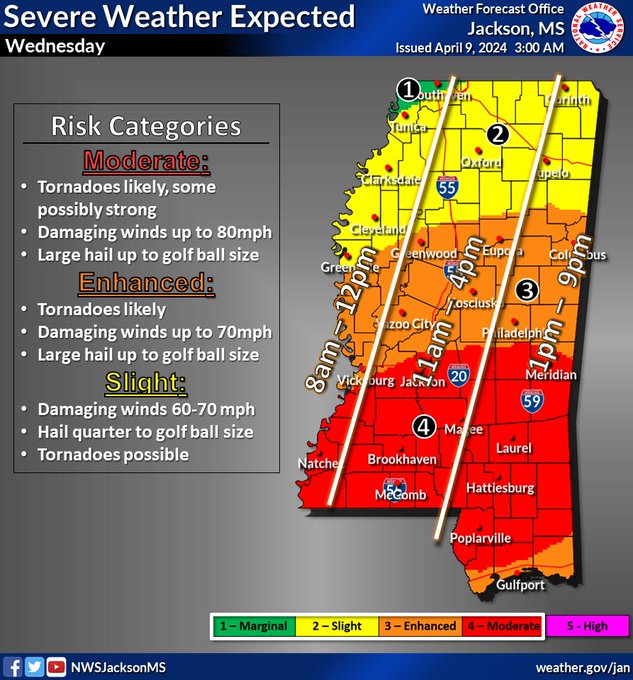
The Mississippi Emergency Management Agency is monitoring the potential for severe storms on Wednesday.
Most of the state could be impacted, especially the southern half. According to the National Weather Service (NWS) in Jackson, the system will begin moving into the western part of the state around 8 a.m. Damaging winds, hail the size of golf balls, and tornadoes are possible.

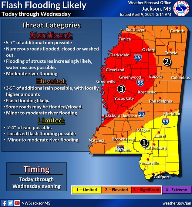
There’s also a potential for flash flooding as soon as Tuesday, according to NWS.
Keep up with the forecast near you by clicking here.


