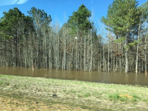
The Mississippi Emergency Management Agency says the Pearl River at Jackson is projected to reach 35.5 feet by this weekend, which would be its highest level since 1983 and would also be a top-15 all-time measurement.
Listed below are the potential impacts the flooding could have could have on the Jackson area as well as in other areas downstream.
PEARL RIVER AT JACKSON
Last updated height: 33.46′ at 8:30 am
Projected height – 35.5′
-31 feet: Water begins to impact homes and businesses in the Byram area
-32 feet: Water beings to affect businesses on South President and South Farish streets in Jackson. Sidney Street is flooded.
-33 feet: Rosemary Road is closed. Sidney Street is impassable. There is water on West Street. The played field off Westbrook Road is under water. Water is on Nichols and Julienne streets in the Hightower area; however, both are passable.
-35 feet: Some businesses are affected on Town Creek Road.
-35.4 feet: Water begins to enter homes in the Hightower Area.
-35.79 feet: Water is close to entering homes in Northeast Jackson.
-38 feet: A large number of homes are flooded in Northeast Jackson and water is in some buildings in Downtown Jackson.
PEARL RIVER NEAR PHILADELPHIA/AT BURNSIDE:
Last updated height – 16.25′ at 8:45 am
Projected height – 17′
-14 feet: Water begins to cover some of the Burnside Lake Water Park roadways and camps
-15 feet: Most of the camping areas and roadways in Burnside Lake Water Park are covered by flood waters.
-17 feet: The open-air pavilion at Burnside Lake Water Park is inundated.
19.5 feet: Water reaches the under clearance of the State Highway 15 bridge.
PEARL RIVER NEAR CARTHAGE
Last updated height – 23.6′ at 8:45 am
Projected height – 24′
-24 feet: Several roads and streets south of State Highway 16 and west of State Highway 35 are under water
-26 feet: The evacuation of residents and businesses south of Carthage may be necessary.
-27 feet: Five state highways and several county roads are closed due to high water. Also, several homes in Leake County and in the city limits of Carthage are affected by high water.
PEARL RIVER NEAR MONTICELLO
Last updated height: 28.47′ at 8:15 am
Projected height: 28.6′
-26 feet: Water covers Old Highway 27 about seven miles north of Monticello near Saint James Missionary Baptist Church.
26.5 feet: Flooding occurs near the Highway 84 bridge at Atwood Water Park.
28.5 feet: The entire Atwood Water Park is under water.
PEARL RIVER NEAR BOGALUSA
Last updated height: 21.22′ at 9:00 am
Projected height: 21.6′
-20 feet: Woodlands and crop acreage along the river will be flooded. The Bogue Chitto Wildlife Management area will be innundated with water in recreational camps and over access roads/
-21 feet: Woodlands and crop acreage along the river will be flooded. The Bogue Chitto Wildlife Management area will be inundated with water in recreational camps and over access roads. At 21 feet, property east of Louisiana Highway 21 along Bogalusa Creek will begin to flood.
-22 feet: Woodlands and crop acreage along the river will be flooded. The Bogue Chitto Wildlife Management area will be inundated with water in recreational camps and over access roads. At 21 feet, property east of Highway 21 along Bogalusa Creek will begin to flood. Bogalusa Creek will back up threatening the Sewage Treatment Plant. Homes south of Bogalusa Creek and east of Highway 21 will flood.
PEARL RIVER NEAR PEARL RIVER
Last updated height: 17.05′ at 9:00 am
Projected height: 17.6′
-14 feet: Secondary roads to the river and throughout Honey Island Swamp are inundated. Property in the vicinity of the gauge is flooded threatening about 20 homes along the left bank.
15.5 feet: Secondary roads to the river and throughout Honey Island Swamp are inundated. Property in the vicinity of the gage is flooded threatening about 20 homes along the left bank. The Bogue Chitto National Wildlife Refuge will be closed to hunting at the 15.5 foot stage.
16 feet: Lower portions of streets in River Gardens Subdivision will begin to flood. Secondary roads to the river and throughout Honey Island Swamp will remain inundated. Property in the vicinity of the gage is flooded threatening about 20 homes along the left bank. The Bogue Chitto National Wildlife Refuge will be closed to hunting at the 15.5 foot stage.
17 feet: Improved roads near the river will be covered with low water. Gum Bayou will back up flooding the lower portions of streets in River Garden Subdivision. Secondary roads to the river and throughout Honey Island Swamp will remain inundated. Property in the vicinity of the gage is flooded threatening about 20 homes along the left bank.


