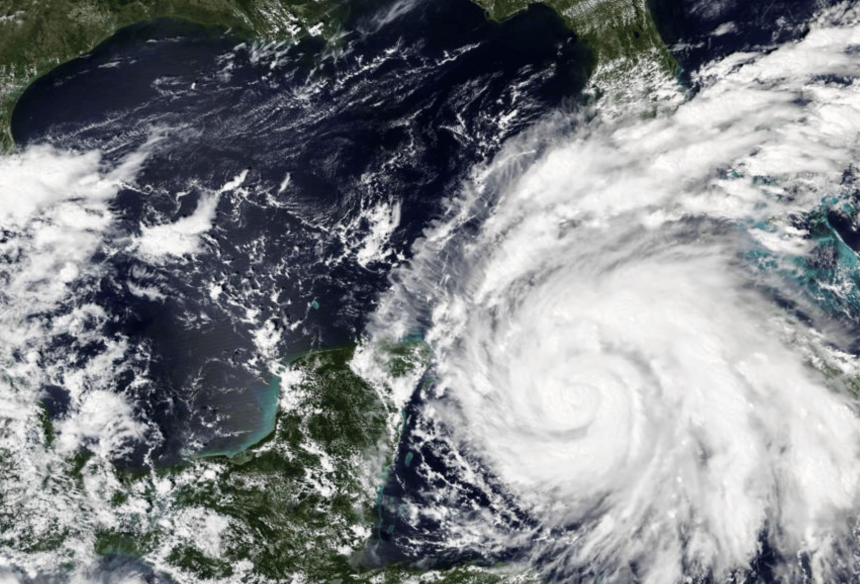
Hurricane Ian made landfall in Cuba Tuesday morning and is now heading toward Florida.
The Category 3 storm initially hit Cuba’s Pinar del Rio province, where officials and emergency personnel had already set up 55 shelters among other preparative steps. According to the U.S. National Weather Service (NWS), the island’s west coast is currently seeing significant wind and storm surges.

Now barreling towards the west coast of Florida, Ian could hit the U.S. as a Category 4 storm as early as Wednesday.
“Life-threatening storm surge looks increasingly likely along much of the Florida west coast where a storm surge warning is in effect, with the highest risk from Fort Myers to the Tampa Bay region,” a release from NWS reads. “Residents in these areas should listen to advice given by local officials and follow evacuation orders if made for your area.”
Here are the 11 AM EDT Sep 27 Key Messages for Hurricane #Ian. Residents in the Hurricane and Storm Surge Warning areas should rush all preparations to completion and follow the advice and evacuation orders of local officials. More: https://t.co/tW4KeGdBFb pic.twitter.com/iT2nCxb4O3
— National Hurricane Center (@NHC_Atlantic) September 27, 2022
As for the the Florida Panhandle, Fox News Senior Meteorologist Janice Dean warns residents of the area to be ready.
“For those along the Florida Panhandle — very key here — I don’t want you to say, ‘Well, this isn’t going to hurt me,’ because the potential is there for this storm to affect the whole state of Florida,” Dean said.
Upon landfall in the U.S., Ian could bring residual rain and winds to the Mississippi Gulf Coast.


